As part of our Coastal Home building guide for Mississippi, we have created an article to help a future homeowner find an approximate elevation for their lot. There is a tool available from Mississippi that uses Lidar data to determine approximate elevations for a lot.
You can open the site at
http://www.gis.ms.gov/portal/viewer.aspx
This site gives you access to the Mississippi Geospatial Clearinghouse. Once there you can zoom the map to your property’s location.
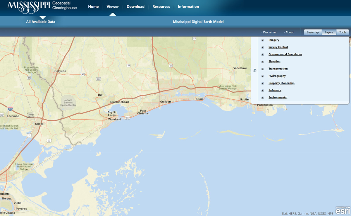
Once you zoom into your location, it is important to center the location on the screen before adding the elevation layer.
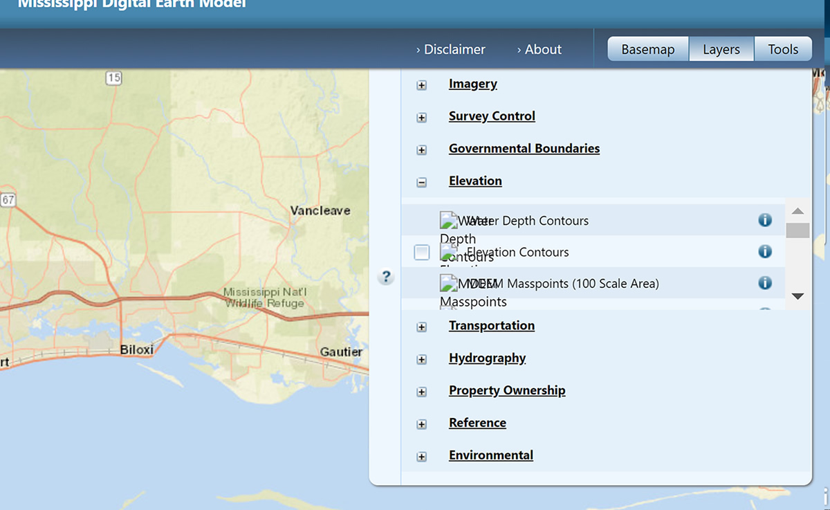
Choose the elevation layer from the top right layers section on the layer panel. You are wanting to click on the Masspoints (100 Scale Area). This will turn on elevation dots.
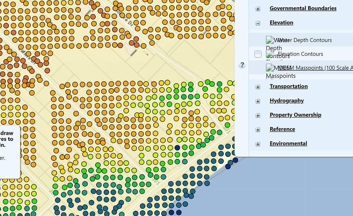
This will create a large selection of dots on the map. Each dot will be an estimate of the ground’s elevation at that location.
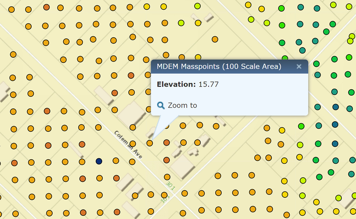
Click on any of the dots to see the approximate elevation for that space. It is only an estimate, the only way to know for sure what an elevation is for a specified piece of property is to hire a licensed Mississippi Land Surveyor to provide an elevation survey. These surveys are part of the path to building a home in the floodplain.
Here are a few more tools to help you when working to build a new home on the coast of Mississippi:
Coastal Building Guide for Mississippi
Find the owner os a lot in Coastal Mississippi